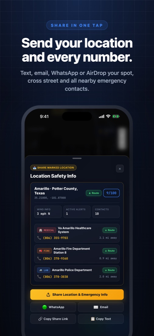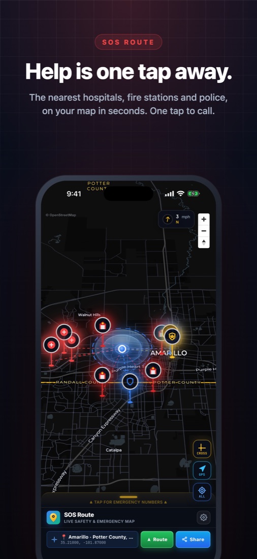
360° Radar + 1-Tap Share Location & SOS: Plots directional bearings to the closest Hospital, Fire & Police with 1-tap calling, a Share Current Location button (iMessage, WhatsApp, AirDrop), and instant SOS trigger right from the widget.
Help Is One Tap Away.
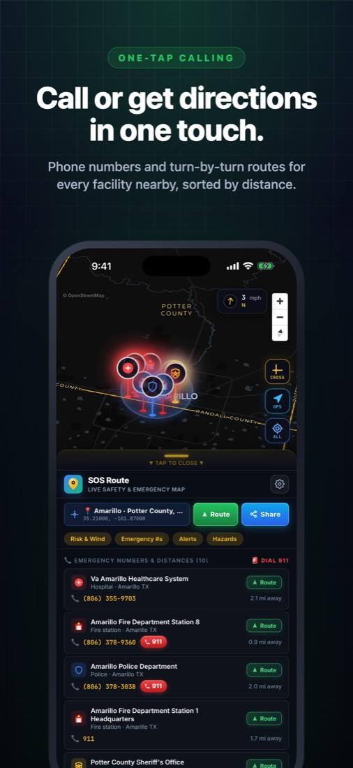
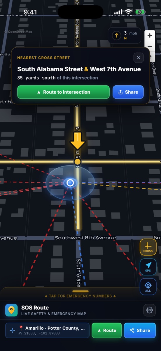
Instant nearest hospitals, fire stations, and police anywhere in the U.S. & Canada — with 1-tap calling, 1-tap Location Share, a 50+ mile rural cross-street finder, live federal hazard alerts, and our upcoming v1.1 Home Screen Radar Widget & Watch SOS.
7-day free trial included · No account signup · No credit card required to start
Rural Cross-Street
Finds intersections off-grid
Verified Responders
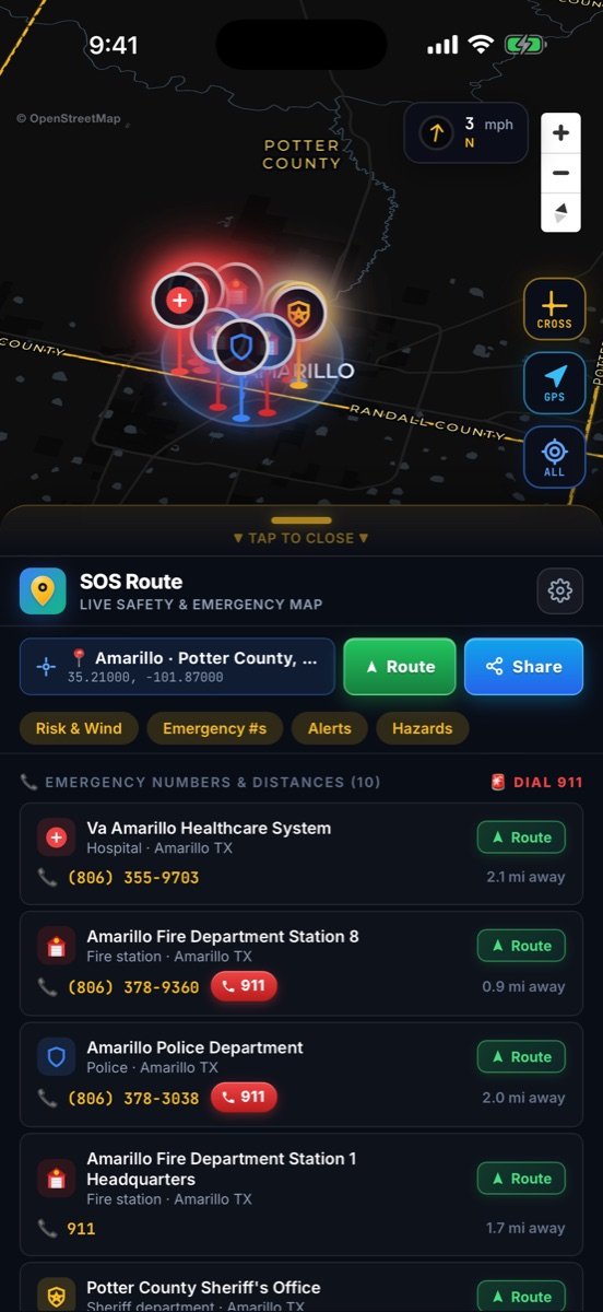
Hospitals, Fire & Police
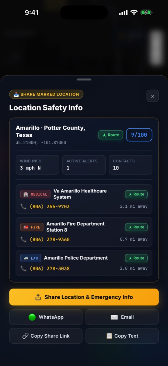
Instant Location Share
Text GPS + Cross-Street
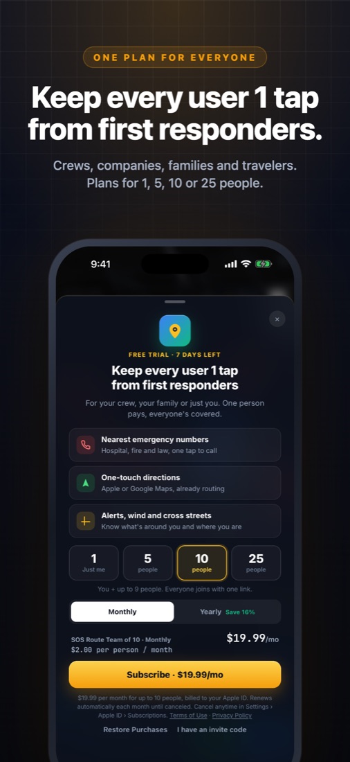
Crew & Family Plans
Covers 1 to 25 iPhones
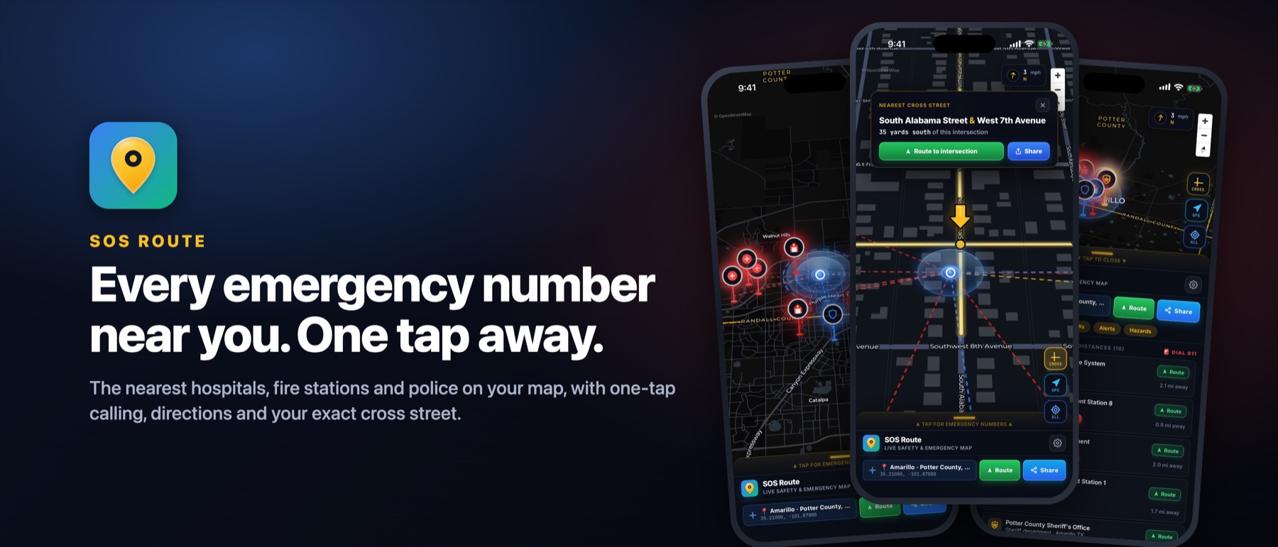
Every Second Counts. See Every Screen.
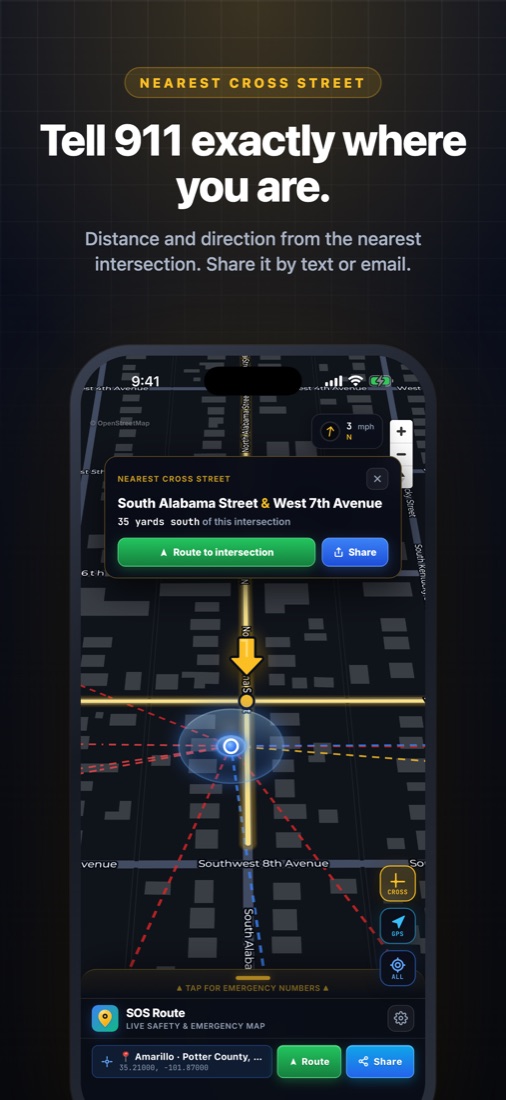
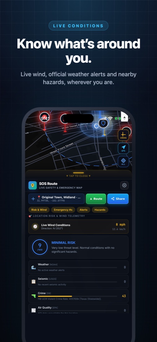
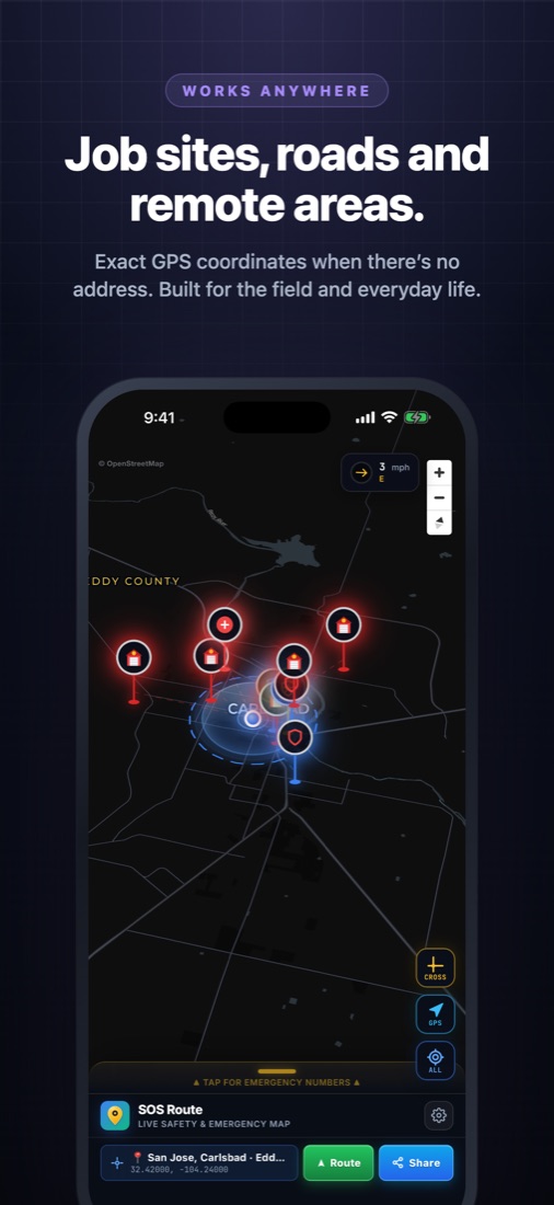
Designed for high-stress moments when you need the closest emergency room, fire station, police precinct, or exact cross street immediately. Click any poster to inspect full size.
Everything You Need When Seconds Matter.
Powered by the SOSRoute safety infrastructure platform — combining 92,000+ verified emergency facilities, OpenStreetMap global coverage, and 8 U.S. federal agencies.
Nearest Hospitals, Fire & Police
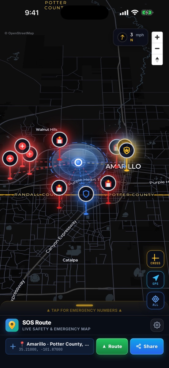
Automatically ranks the closest emergency rooms, fire stations, and law enforcement precincts around your live GPS coordinate or any dropped pin on the map.
50+ Mile Rural Cross-Street Engine
Unlike standard maps that only show a street address, SOS Route decodes vector road geometry directly to tell you the exact distance and compass direction to the nearest intersection — even 50 miles out in rural Texas or Nevada.
1-Tap Location Share & Widget HUD
Share your live GPS pin, cross street, Apple Maps link, and nearest ER/Fire/Police numbers in one tap from the app today — plus Home Screen & StandBy Radar Widget support arriving in v1.1.
Apple Watch 3s Hold & Black-Box SOS (v1.1)
Upcoming v1.1 expansion: Hold for 3 seconds on your Apple Watch or iPhone to text your Emergency Contacts a delay-proof Black-Box briefing with exact capture timestamp, travel speed, compass heading, and nearest EMS.
Live Wind Speed & 8-Agency Hazard Radar
Displays real-time surface wind speed, gusts, and directional arrows on the map alongside a 0–100 Safety Risk Score powered by NOAA weather, USGS seismic, NIFC wildfires, and EPA air quality.
100% Privacy-First Architecture
No user accounts, no passwords, no phonebook scraping, and no background tracking. Pick only the 1–5 Emergency Contacts you want via Apple's native contact picker.
v1.1 Preview: Tactical Radar Widget & Wrist SOS.
Arriving in our next update: live 360° responder radar on your iPhone Home Screen with a 1-tap Share Location button, plus a 3-second Long-Hold SOS button on your Apple Watch & iPhone that sends a Black-Box telemetry text (with exact capture timestamp, travel speed, motion state & nearest EMS) to your emergency contacts.
Anti-Pocket-Dial 3-Second Hold: Press and hold for 3 seconds on your Apple Watch or iPhone to lock your GPS, speed, heading & timestamp and text your iPhone Emergency Contacts.
SOS EMERGENCY ALERT I need help at my current location. CAPTURED: Nov 7, 2026 · 8:59:52 PM (Pin time locked if delayed by signal) MOTION: Driving · 62 mph (100 km/h) HEADING: West-Northwest (284°) CROSS ST: 110 yds W of Main & Oak GPS PIN: 29.7604, -95.3698 (±12 ft) [ER] Methodist ER (0.8mi) 713-790-3311 [FD] HFD Sta. 8 (0.5mi) 832-394-6700 [PD] HPD Central (0.6mi) 713-222-3131 MAPS: maps.apple.com/?ll=29.7604,-95.3698
Built for Low-Signal Dead Zones: Stamps the exact capture time, travel speed, and compass bearing inside the message body so if cell signal delays delivery by 20 minutes, responders still know when and which direction you were moving.
Roll Out to Your Entire Crew in Under 60 Seconds.
No IT department, no spreadsheets of emails, and no passwords to reset. One supervisor, business owner, or parent subscribes on their iPhone and shares a single invite link.
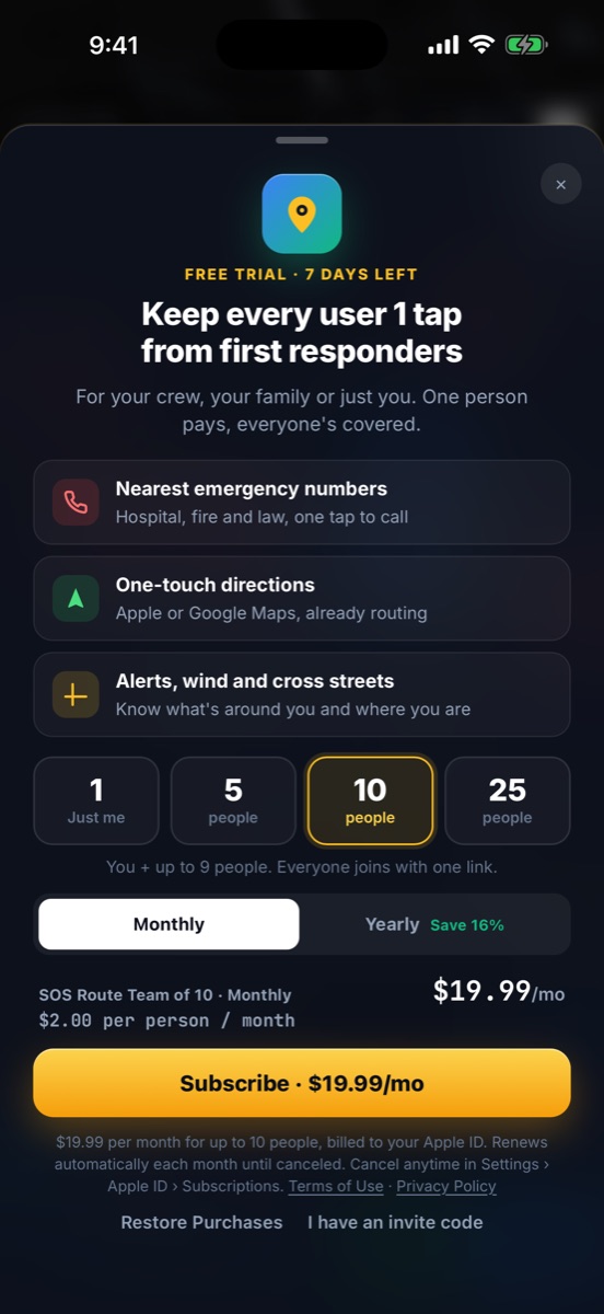
Choose a 5, 10, or 25-Person Plan
Subscribe in seconds using Apple In-App Purchase on your iPhone. Every plan starts with a 7-day free trial.
Drop One Link in Your Group Text or Slack
Tap "Text Invite" or "Email Invite" in Settings to share your team's unique Universal Link (sosroute.dev/join/CODE).
Get Instant Email Alerts as Members Join
Each crew member taps the link, enters their name, and is immediately covered. You get an instant email notification and can manage or remove seats anytime.
Less Than $2/Month Per Person. 2 Months Free on Annual.
Every download includes a full 7-day free trial with no card required up front. Subscribe solo or cover your whole family or field crew with one link.
- 7-day free trial included
- Nearest hospitals, fire & police
- 1-tap calling & turn-by-turn route
- 50+ mile rural cross-street finder
- Live wind & federal hazard alerts
- Covers up to 5 iPhones
- 1-link family & crew onboarding
- Email alerts when members join
- Remove or rotate seats anytime
- All pro safety & map features
- Covers up to 10 iPhones
- Share 1 link to your crew chat
- Instant owner join notifications
- Full member roster in Settings
- Ideal for contractors & field teams
- Covers up to 25 iPhones
- Built for oilfield, HSE & fleets
- 1-link company-wide rollout
- Instant email audit trail on joins
- Self-serve seat management
Part of the Sandbox Synergy Applied Infrastructure Network.
SOS Route is engineered by Sandbox Synergy — building real-time emergency APIs, spatial AR safety platforms, GIS mapping engines, and Done-For-You custom software, private AI tools, and branded AI training video series.
SOSRoute Developer API (sosroute.dev)
Embed the same 92,000+ emergency responder database, 0–100 location safety risk scores, and 8-agency federal hazard feeds into your own apps, fleets, and AI agents via REST & MCP.
Sandbox Synergy Done-For-You Foundry
Custom commercial websites, private in-house AI workspaces (zero training on your data), custom-branded AI training video courses, and 12 snap-on business automation modules.
WorkARound Spatial AR & Smart Glasses
Hands-free spatial AR hazard overlays, GPS safety markers, and offline field intelligence for industrial crews and smart glasses at workaround.mobi.
FracPin Automated GIS & Well Mapping
Automated geospatial permit intelligence, pad routing, and regulatory mapping tracking 44,500+ oil, gas, and injection filings across 700+ operators.
OilHand Energy & Field-Crew Network
Vertical social platform for energy workers and field contractors with live GPS crew mapping, 1-click job boards, and encrypted crew messaging.
Full Ecosystem & DevRel Hub
Browse all Sandbox Synergy platforms, Done-For-You AI & Web services, AI agent discovery specifications, and our complete cross-domain sitemap.